Community
12 January, 2025
‘Shocking’ damage revealed
JAMES Cook University scientists predict it will take years for the environment to recover after sediment-laden floods caused extreme damage following Cyclone Jasper a year ago.

JCU TropWATER surveys reveal that mud still smothers inshore coral reefs, while mangrove forests have suffered some of the worst flood damage ever recorded, with century-old trees uprooted and others dying with roots covered in mud.
On December 13, 2023, Cyclone Jasper made landfall as a category 2 and travelled across two World Heritage sites – the Great Barrier Reef and the Wet Tropics of Queensland. The slow-moving nature of the cyclone and record-breaking rainfall has made it one of the most sediment-laden floods in the region’s history.
250km coastline survey
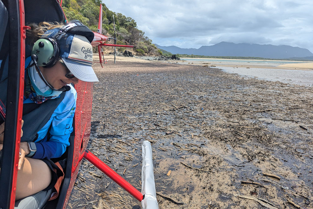
JCU TropWATER scientists surveyed over 250km of coastline – about 40km south of Cairns to Cooktown – assessing damage and identifying restoration sites for mangrove forests, inshore coral reefs, and seagrass habitats.
JCU marine ecologist Dr Abbi Scott said the damage to coral reefs was devastating.
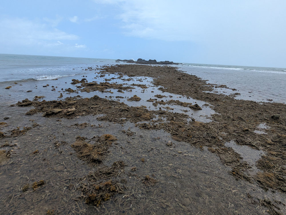
“All of the intertidal fringing coral reefs we observed were smothered under mud. These reefs won’t be able to recover and recruit more coral until that mud moves off, and we don’t know how long this will take,” she said.
“But there are signs of resilience in other habitats. We observed some seagrass in the region – it was patchy but is a positive indication of the potential for recovery as we have seen in other areas after floods.”
The team surveyed over 600 inshore sites by helicopter to assess fringing coral reefs and seagrass meadows, exposed during recent low tides. Deeper coral reefs and seagrass meadows will continue to be surveyed in 2025 with local Traditional Owner groups.
Muddy reefs
“We could see some mud on the deeper reefs too, and it will stay in the system for some time. Waves and tides will keep stirring up the mud, which leads to murky water with less light, making it harder for coral reefs and seagrass meadows to recover,” she said.
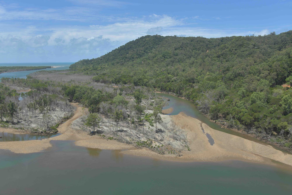
Professor Norm Duke, a senior mangrove ecologist at JCU, who led the aerial and field mangrove surveys, said the Bloomfield River estuary was the worst hit. “Established mangrove forests were extensively damaged, flattened and uprooted, along with standing trees dying by root burial from layers of deposited sediment,” he said.
‘Shocking’ damage
“This is the worst flood damage of mangroves I’ve ever seen. It was truly shocking and catastrophic.
“Entire estuary sections of mangroves were eroded, with trees uprooted and swept away by the floods.
“Nearby estuaries like the Daintree River were also severely impacted, with sediment build-up suffocating inner stands of mangrove trees – some more than 300 years old.”
Professor Duke said that over the next five to six years, soil-binding roots of dying mangrove trees would degrade, releasing their hold on tons of muddy sediments, likely to harm downstream ecosystems for decades to come.
“This sediment release will worsen water quality and disrupt recovery of nearby marine habitats like seagrass meadows and coral reefs, putting even more pressure on the natural balance of interconnected coastal marine ecosystems,” he said.
Future monitoring efforts will use satellite mapping, aerial surveys, and field monitoring to continue to assess recovery and guide potential restoration strategies. Results from this project will help governments prioritise recovery efforts, focusing on reducing short and long term impacts on coastal ecosystems.
Dr Scott said the scale of environmental impacts started with understanding what had been lost and what could be recovered before the region faces another disturbance.
“By tracking recovery over time, our data can help guide management decisions to support these vital coastal habitats for the future,” she said.
‘Disheartening’ sights
“While the results are disheartening, empowering local Traditional Owners to survey their Sea Country and shape future monitoring efforts brings deeper purpose to the project through the relationships we develop.”
Scientists will continue to work closely with the Traditional Owner groups that participated in the intertidal surveys (Jabalbina Yalanji, Dawul Wuru, Gunggandji PBC, and Gunggandji-Mandingalbay Yidinji PPBC Aboriginal Corporations) and others from the impacted areas as they shift to boat-based surveys.
This project is part of the Queensland and Australian Government initiative under the National Environmental Science Program and Commonwealth-State Disaster Recovery Funding Arrangements.


